Manage Agricultural Risks. Receive Timely Notifications.
Monitor your fields remotely, get insights, and make smart decisions — all in one platform.
TRY NOWCrop Monitoring Platform For Remote Farm Risk Management
Identify problems and risks in the fields to make effective decisions
Simplify and speed up your precision crop analysis and vegetation health monitoring
Optimize resources and farm operations with our satellite-driven features
Ways To Make Your Farm Work Efficiently
Get Comprehensive Crop Analytics
We collect complex data from diverse sources and turn it into clear, simple insights just for you. Access farm analytics: history, weather, and vegetation data — all you need for smarter, faster farming decisions.
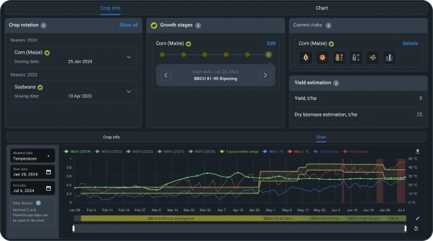
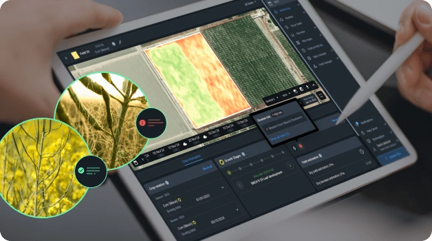
Monitor Crop Health Remotely With Satellite Images
Skip the field trips. Stay updated on plants’ health and growth stages with fresh satellite images. Keep an eye on crop conditions, spot problem areas, track vegetation changes, and monitor soil moisture — all from your screen.
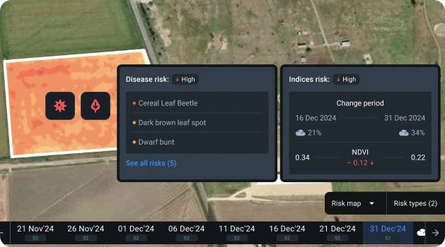
Get Notified About Risks
We'll inform you about any potential problems before they become major issues. Tackle vegetation health changes head-on and protect your yield.
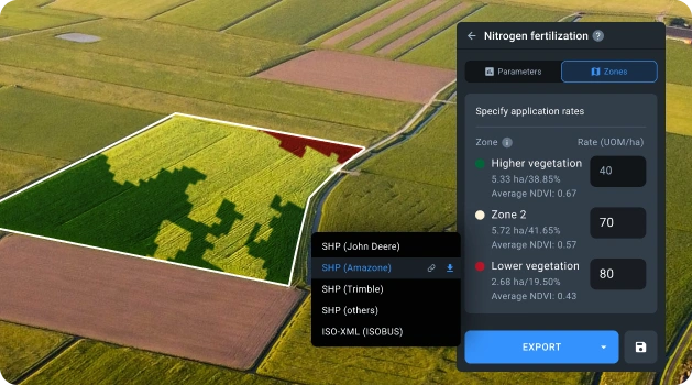
Optimize Resource Usage
Why waste resources? Use Variable Rate Application (VRA) maps to save on fertilizers, water, seeds, and fuel. Spend less, harvest more.
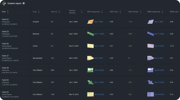
Сustomize Reports
Set up customizable reports to access field information in a clear and convenient table format. Create and share reports and insights with your team and stakeholders in a snap.
Simplify Farming In 6 Steps
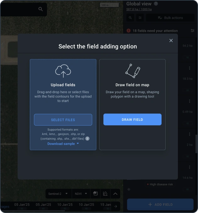
Add Your Fields
Upload a file with land plot boundaries or draw them. Add info about current and previous seasons.
Access Satellite Data
Analyze Trends
Check Current Risks
Take Action
Share Data
Case Studies
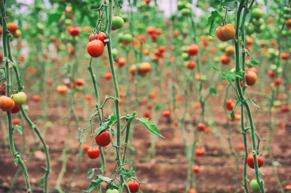
The Morning Star's Gradient Implements Remote Sensing
The Morning Star combines in-ground sensor data with satellite imagery analytics to ensure proper irrigation and increase tomato yields in California.
Read More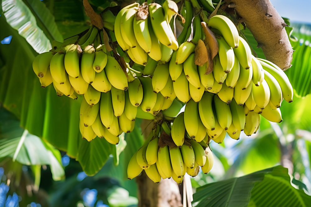
Dole Asia's Leap Into AgTech With Agright Technologies
Agright Technologies assists Dole Sunshine in the Philippines in controlling fungi on banana plantations using satellite imagery analytics offered by TGGDA Crop Monitoring.
Read More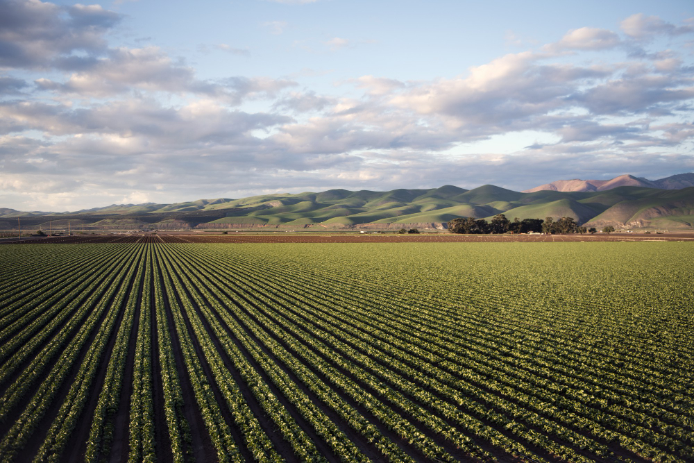
FANCAMPO Mexico Uses Remote Sensing For Crop Insurance
Agricultural insurance in Mexico rises to the next level with the FANCAMPO fund employing satellite imagery analytics through TGGDA Crop Monitoring for damage claims assessment.
Read More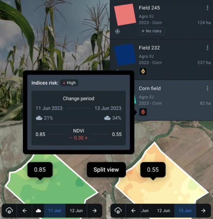
What Our Clients Say
Engr. Jessve D Daypuyart
President at Agright TechnologiesTGGDA Crop Monitoring is revolutionizing agriculture by letting the data speak for itself, transforming satellite imagery into actionable insights for crop health and environmental conditions. Agrights’ cooperation with TGGDA exemplifies this revolution, enabling us to define, develop, and deliver on-point, data-driven solutions to our partners.
Manelick Alejandro Malagón Martínez
Coordinator at Agribest TechnologiesSome clients ask how we identify specific issues in their plots without physically inspecting the fields. We explain that TGGDA Crop Monitoring, the platform we use, allows our specialists to monitor plot conditions remotely through remote sensing technologies. This means they don't need to personally visit the fields.
Anya Petrova
Farm Manager at Sunfield OrganicsThe VRA maps have been a game-changer for us. We've cut our fertilizer costs by nearly 20% while increasing our overall yield. The platform paid for itself in the first season. The ability to monitor everything from my tablet is just incredible.
Carlos Mendez
Head of Innovation at Terra Verde GroupAs an agricultural consultancy, TGGDA provides us with the scalable tools we need to serve our clients effectively. The risk notifications and historical weather data allow us to give proactive, data-backed advice that our clients trust. It's an indispensable part of our toolkit.
Who can benefit from TGGDA Crop Monitoring solutions?
Challenges:
- Data overload without practical insights
- Inaccurate or delayed information
- Limited connectivity in rural areas
- Lack of weather and yield forecasting
- Lack of crop-specific data
- Fertilizers and resources overuse
Our Solution:
- Use vegetation indices and growth stages to monitor plants' health
- Get automated notifications about risks
- Use VRA maps to optimize resources
- Access weather data: historical and precise forecasts
- Manage fieldwork and scouting smartly
- Enjoy unlimited team accounts
Challenges:
- Limited customization for advisory needs
- Challenges analyzing large-scale data
- Lack of teamwork tools for client field management
- Limited predictive tools for insights
- Low client trust in consultant advice
Our Solution:
- Create and share custom reports on crop insights
- Access historical weather and vegetation data
- Use field leaderboard to manage multiple clients' land plots
- Monitor crops remotely across all clients
- Connect advisors and team in one account for efficient collaboration
- Receive predictive risk alerts
- Access satellite and machinery data within one platform
- Use VRA maps for smart resource allocation
Contact Us
Have questions? Get in touch with us through the form or using the details below.
info@yourcompany.com
Phone
+91 98765 43210
Address
123 Business
Street,
Hyderabad, India